
© Liz Carlson
TRAVEL
PARTNER

Out of the Northwest Passage

Special Guest
David Jordan
Executive Director, Vancouver Maritime Museum
September 2 to September 18, 2028
From $18,995 to $37,495 USD
per person based on double occupancy
Save 25% Applies to berth cost only.
CAD pricing available for Canadian residents
The Passage in a New Light
Travel eastward through the Northwest Passage as Arctic autumn gathers. From the rolling tundra and intricate waterways of the western Arctic to Greenland’s glacier-carved coast, journey through Inuit Nunangat amid deepening fall colours, cooler air, and skies dark enough for the aurora. In partnership with the Vancouver Maritime Museum, mark one hundred years since the St. Roch was launched for Arctic service. Inuit educators, expert guides, and guest David Jordan explore the Passage’s living cultures, wildlife, history, and maritime legacy.

Map

- Day 1: Kugluktuk (Coppermine), NU, Canada
- Day 2–4: Kitikmeot Region
- Day 5: Ikirahaq (Bellot Strait)
- Day 6: Beechey Island
- Day 7–8: Tallurutiup Imanga (Lancaster Sound) and Devon Island
- Day 9: Ausuittuq (Grise Fiord)
- Day 10: Smith Sound
- Day 11: At Sea
- Day 12–13: Northwest Greenland
- Day 14: Ilulissat
- Day 15–16: Sisimiut Coast
- Day 17: Kangerlussuaq, Greenland
Itinerary
-

© Jacquie Matechuk
The voyage begins in Inuit Nunangat, the Inuit homeland encompassing the land, water, and ice of Arctic Canada. At its western edge, Kugluktuk stands where the Coppermine River enters Coronation Gulf. Its Inuinnaqtun name means “place of moving waters,” reflecting the currents and rapids that have long defined this meeting of river, tundra, and sea.
Kugluktuk is an Inuinnait community shaped by close relationships with the river and surrounding nuna (the land). Fishing, harvesting, artistic expression, and travel on the land remain central to life here, while Inuinnaqtun carries knowledge and stories particular to the western Arctic. Time with local hosts introduces the people and cultural region whose homelands frame the first days of the journey.
After boarding the Ocean Victory, the route turns east beneath the lower light and deepening colours of Arctic autumn. The voyage also marks one hundred years since the St. Roch was launched for Arctic service. In partnership with the Vancouver Maritime Museum, its history becomes one thread within a much larger journey through Inuit Nunangat.
-
© Vancouver Maritime Museum
Western Kitikmeot opens in low tundra, scattered islands, wetlands, and distant horizons. Wide sounds narrow into channels that weave among gravel coastlines and archaeological sites. Muskoxen and caribou move across the land, while seals and whales travel the surrounding waters and migratory birds gather as autumn advances.
This is the Inuinnait country, a distinct regional group of Inuit whose language, Inuinnaqtun, carries an intricate geography of place names, travel routes, stories, and ecological knowledge. Generations of harvesting caribou, muskoxen, seals, and fish have shaped distinctive clothing, tools, food traditions, and patterns of movement. Today, Inuinnait communities are strengthening the transmission of their language and culture while adapting these traditions within contemporary life.
The St. Roch spent two winters in this region during its 1940–42 crossing, first at Walker Bay on Victoria Island and later at Pasley Bay on the Boothia Peninsula. During these extended stays, crew members learned ice-fishing and hunting methods from Inuit whose knowledge helped them adapt to Arctic conditions. Those long winters in the ice speak to the distance, uncertainty, and challenges of navigating the Arctic in a wooden vessel. Today, landings, tundra walks, community visits, and Zodiac explorations bring the people, wildlife, and expansive landscapes of Kitikmeot into view.
-
© Liz Carlson
Ikirahaq is a narrow, twenty-five-kilometre passage separating Somerset Island from the Boothia Peninsula. At its narrowest, little more than a kilometre divides the shores. Strong tidal currents move through the channel as waters from the eastern and western Arctic meet beneath steep granite walls.
In 1942, the St. Roch entered Ikirahaq during the final year of its west-to-east crossing. Moving ice pressed the wooden schooner against grounded floes as the tide drove more ice into the strait. The vessel eventually broke free and continued east, making this one of the most perilous moments of its twenty-seven-month passage.
Seals, whales, seabirds, and occasionally polar bears may be encountered along the shores or among the moving ice. On the southern side lies Murchison Promontory, the northernmost point of mainland North America. Passage through Ikirahaq remains governed by powerful currents, ice, weather, and careful navigation.
-
© Liz Carlson
At Beechey Island, history lies close to the surface. In 1845, Sir John Franklin set out from England with HMS Erebus and HMS Terror, attempting to sail through the Northwest Passage. His crew overwintered here, where three of his men died. Later, in 1854, Thomas Morgan of HMS Investigator was buried beside them—a solemn witness to the relentless search for Franklin’s lost expedition.
Beechey became a depot and landmark for numerous search parties that followed. Amundsen and Bernier stopped here, as did Henry Larsen aboard the St. Roch on August 20, 1944. Given the island’s importance to British Arctic exploration and the Franklin Expedition, the visit held particular significance for Larsen and his crew. Archival photographs capture crew members gathered beside the Franklin Expedition cenotaph, adding their own presence to the island’s layered history.
Nearby stand the ruins of Northumberland House, while the surrounding landscape remains stark and wind-scoured: gravel, ice, and the call of gulls echoing across still water. Standing here, you feel the continuity between ambition and endurance—held quietly in the land’s enduring silence.
Inuit testimony proved essential to tracing the expedition’s final movements and, generations later, locating its lost ships. Beechey Island connects Franklin’s failed voyage with its wider legacy, including expanded geographical knowledge, growing colonial ambitions, and an increasingly sustained southern presence in Inuit Nunangat.
-
© Jacquie Matechuk
Tallurutiup Imanga is the ecological engine of the eastern Canadian Arctic. Nutrient-rich waters and recurring areas of open water support narwhal, beluga and bowhead whales, walrus, seals, polar bears, and some of the Canadian Arctic’s largest seabird colonies. As autumn approaches, marine mammals continue to move through its channels while migratory birds gather before turning south.
This National Marine Conservation Area has supported Inuit travel, harvesting, and cultural practice for millennia. Inuit stewardship and Inuit Qaujimajatuqangit, or Inuit knowledge, play an essential role in its protection. Inuit expedition team members and naturalists bring the relationships among currents, ice, wildlife, and human life into focus.
After navigating Ikirahaq in 1942, the St. Roch continued through Prince Regent Inlet and entered Tallurutiup Imanga on its way towards Baffin Bay and the Atlantic. After two winters in the western Arctic, these broad eastern waters marked the final stage of its historic west-to-east crossing. Two years later, the schooner passed through Lancaster Sound in the opposite direction during its single-season return voyage.
To the north, Devon Island rises in broad plateaus, glacial valleys, gravel plains, and open tundra. It is the world’s largest uninhabited island, although archaeological sites attest to centuries of Inuit and earlier human presence. Walks and Zodiac explorations reveal autumn vegetation, immense geological scale, and coastlines approached most naturally from the sea.
-
© Dennis Minty
Set between the mountains and sea of southern Ellesmere Island, Ausuittuq means “the place that never thaws.” Canada’s northernmost civilian community occupies a landscape of glaciers, open tundra, and waters that remain covered by sea ice through much of the year.
The community was established in 1953 through the Canadian government’s relocation of Inuit families from Inukjuak and Mittimatalik. That difficult history remains an important part of Ausuittuq’s story, alongside more than seventy years of community life shaped by family, ingenuity, and cultural continuity. Hunting, travel on the nuna, artistic expression, and the rhythms of the seasons remain closely woven into life here. Time with local hosts offers a view of contemporary High Arctic community life within the immense landscape of Ellesmere Island.
-
© Rob Poulton
Low autumn light draws out the immense scale of Smith Sound, where Greenland and Ellesmere Island rise on either side of a channel linking Baffin Bay with Kane Basin. The sun follows a lower arc across the sky, casting long shadows over mountains and glaciers. Fresh snow may trace the higher slopes, while colder air and extended twilight bring a new character to the passage.
Drifting ice and immense icebergs move through these waters between two great Arctic coastlines. Inuit have long travelled and hunted throughout the region, while nineteenth-century expeditions later followed Smith Sound in search of Franklin and routes towards the North Pole. These histories remain present within a passage still governed by current, ice, weather, and distance.
-
© Jacquie Matechuk
September places Baffin Bay at a seasonal threshold. Sea ice is near its annual minimum, even as colder nights begin the transition towards freeze-up in the bay’s northwestern reaches. Icebergs circulate with the currents, while whales and seals remain active and migratory seabirds move towards their winter ranges.
A day aboard offers time to watch the changing sea and sky from the decks and observation spaces. Presentations, workshops, and informal conversations with Inuit cultural educators, naturalists, historians, and other expedition team members deepen understanding of the wildlife, geography, cultures, and exploration history of the Northwest Passage.
Between sessions, the decks remain a gathering place for shared wildlife sightings and the quiet spectacle of icebergs moving across the horizon. As daylight fades, true darkness returns to the bay, and clear skies may bring the possibility of the aurora.
-
© Jacquie Matechuk
In Kalaallit Nunaat, the Kalaallisut name for Greenland, the northwest coast forms both an immense seascape and a lived cultural world. Kalaallisut, the country’s official language, carries the names, stories, and knowledge of its distinctive shores. Across western Greenland, Kalaallit culture shapes language, food, creative expression, and everyday relationships with the sea.
The northwest coast rises from the water in islands, narrow channels, sheltered bays, and deep fjords enclosed by steep mountains. The West Greenland Current carries immense icebergs northward, gathering bergs from Disko Bay and glaciers farther north into a moving flotilla of towers, arches, and fractured blue faces.
Small communities occupy rocky islands and natural harbours throughout this intricate seascape. Fishing and hunting remain central to local economies and food traditions, while boats connect settlements separated by water and rugged terrain. Autumn deepens the tundra into red, gold, and ochre, setting the final colours of the growing season against dark rock and drifting ice.
Explore the coast by ship, Zodiac, and on foot. Community visits and shoreline walks bring contemporary Kalaallit life and the immense scale of the landscape into view.
-
© Liz Carlson
At Ilulissat Icefjord, a UNESCO World Heritage Site, Sermeq Kujalleq carries ice from the Greenland Ice Sheet towards the sea. Immense icebergs enter Disko Bay in a continually changing procession of towers, arches, and fractured blue faces. Ilulissat means “icebergs,” a name that captures the defining presence of ice within the landscape and community.
A boardwalk leads towards views across the icefjord, while the Ilulissat Icefjord Centre explores the connections among ice, climate, culture, and human history. In town, a working harbour, museums, restaurants, cafés, shops, and colourful neighbourhoods reveal one of Greenland’s most energetic contemporary communities, lived within sight and sound of the moving ice.
-
© Liz Carlson
The Sisimiut coast brings together mountain ridges, sheltered waterways, offshore islands, and long fjords reaching towards the Greenland Ice Sheet. Autumn deepens the colours of crowberry, dwarf birch, willow, and tundra moss, while lower light sharpens the outlines of rock and water. Darkening evenings may also bring opportunities to watch for the aurora borealis.
Human history along this coast reaches back more than 4,500 years. Archaeological traces left by successive cultures, including Saqqaq, Dorset, and Thule peoples, speak to generations of movement and adaptation. Contemporary communities continue to look to the sea for travel, fishing, and connection.
Zodiac cruises, hikes, community visits, and time aboard offer different ways to experience this meeting of coast and fjord. Whales may still be encountered offshore, while seabirds move through the final stages of their seasonal migrations.
-
© Steven Rose
Kangerlussuaq lies within a broad glacial valley between the Greenland Ice Sheet and the sea. Its dry climate and unusually stable weather led to the establishment of an American air base here during the Second World War and continue to make it one of Greenland’s most important aviation gateways. The surrounding region has a much longer history as a place of Inuit travel and hunting.
The journey concludes after sailing through Kangerlussuaq Fjord, one of Greenland’s longest fjords. Mountains, glacial valleys, and pale meltwater mark the transition from the western coast towards the interior. After disembarkation, transfer to the airport for the charter flight south.
From the moving waters of Kugluktuk to this glacial valley, the route has crossed the Northwest Passage from west to east through a season of changing light.


Published itineraries reflect our intended route and experiences but cannot be guaranteed. Weather, sea and ice conditions, government regulations, operational considerations, wildlife, and other circumstances may require changes to the planned schedule. Visits to specific communities also depend on local conditions and the needs, availability, and requests of the communities themselves. When changes are necessary, we will seek the best available alternatives, including another community visit where circumstances allow.
Pricing and Cabins
Exclusively for Canadian residents, we offer pricing in Canadian Dollars—please contact us for details.
-


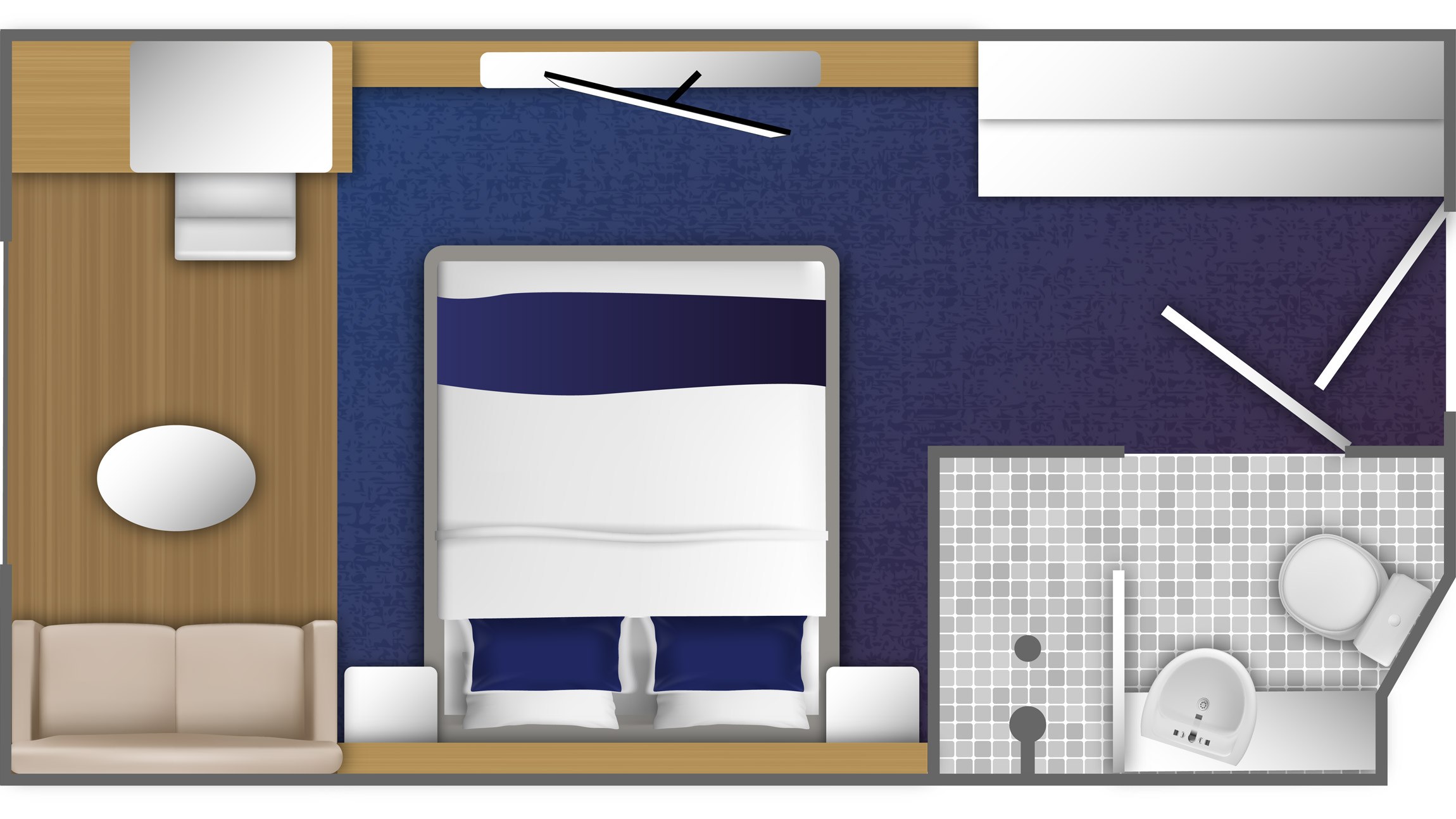
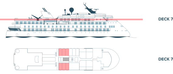
- Floor-to-ceiling windows
- French-style balcony
- One queen size bed
- Bathroom with a shower
- Selection of bath products (body wash, lotion, shampoo) and hair dryer
- Bathrobes and slippers
- Desk with a chair
- Refrigerator
- Private air conditioning
- Television
- Wi-Fi access (basic service included)
- Several 230V outlets and USB ports
- Safety box
- Approximately 151 square feet (14 m²)
- Cabin layout and size may vary
![Deck 7]()
-


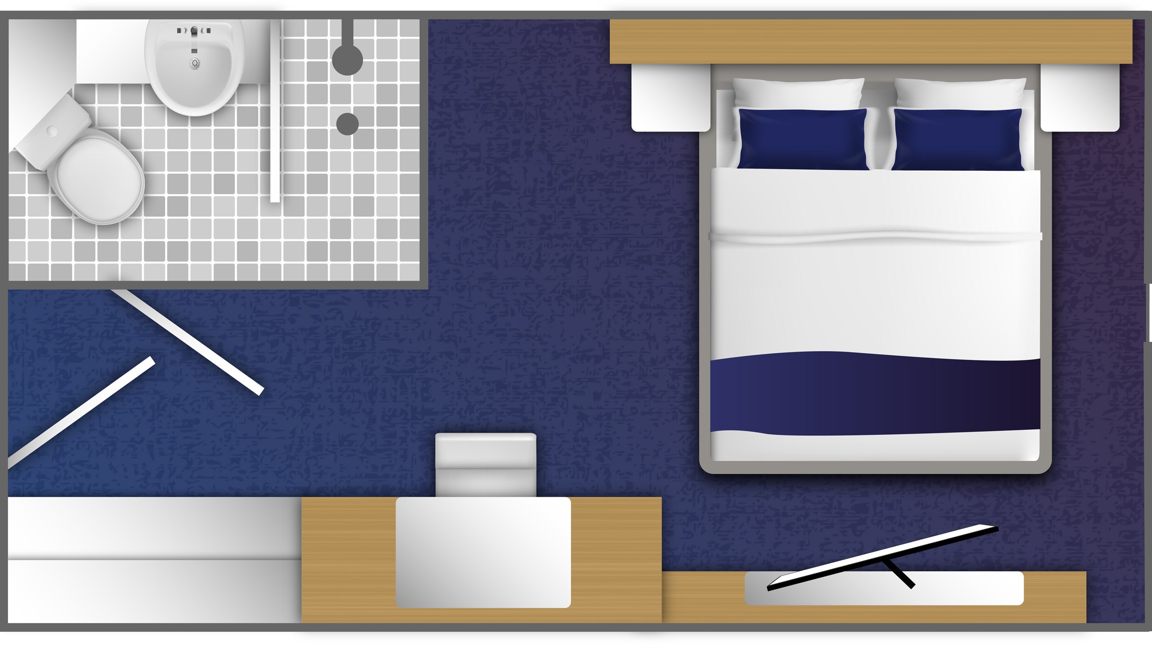
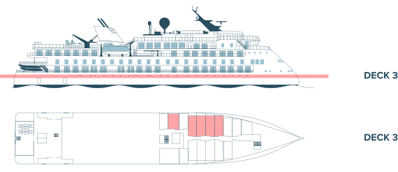
- Porthole window
- Double bed
- Bathroom with a shower
- Selection of bath products (body wash, lotion, shampoo) and hair dryer
- Bathrobes and slippers
- Desk and a chair
- Refrigerator
- Private air conditioning
- Television
- Wi-Fi access (basic service included)
- Several 230V outlets and USB ports
- Safety box
- Approximately 151 square feet (14 m²)
- Cabin layout and size may vary
![Deck 3]()
-


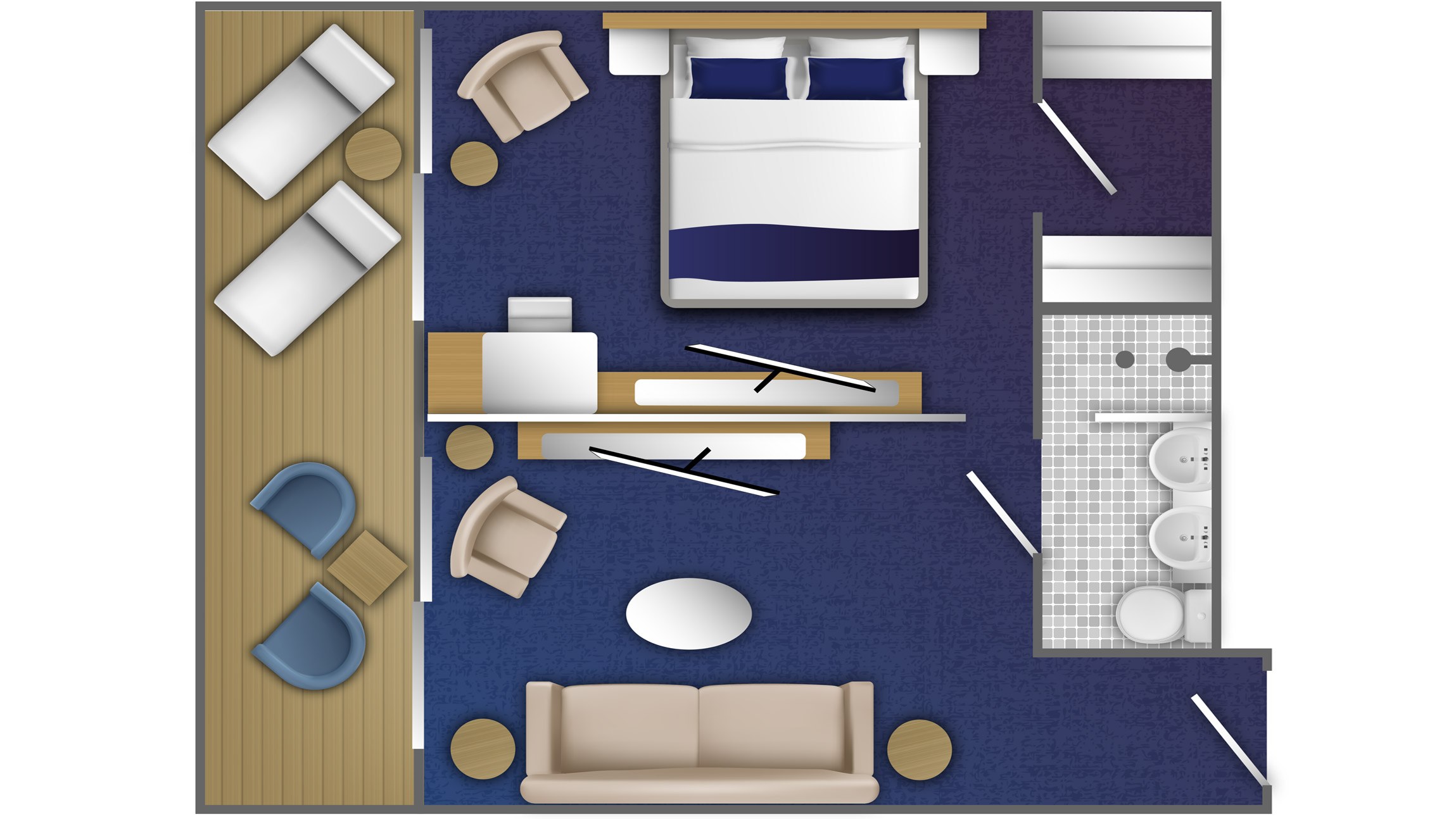
- Private balcony
- Double bed or twin beds
- Spacious bathroom with shower
- Selection of bath products (body wash, lotion, shampoo) and hair dryer
- Bathrobes and slippers
- Sitting area with sofa bed
- Desk and a chair
- Refrigerator
- Private air conditioning
- Television
- Wi-Fi access (basic service included)
- Several 230V outlets and USB ports
- Safety box
- Approximately 452 square feet (42 m²)
![Deck 4]()
-


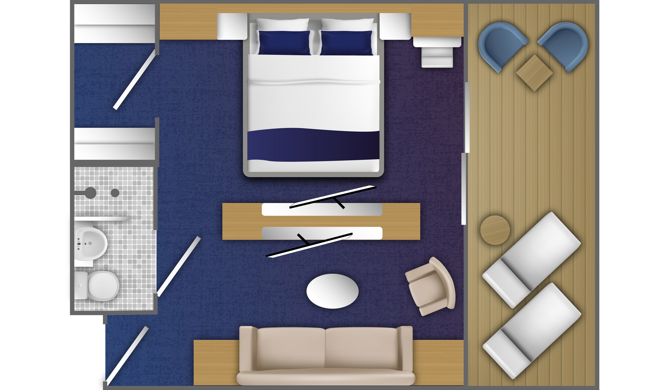
- Private balcony
- Double bed or twin beds
- Spacious bathroom with shower
- Selection of bath products (body wash, lotion, shampoo) and hair dryer
- Bathrobes and slippers
- Sitting area with sofa bed
- Desk and a chair
- Refrigerator
- Private air conditioning
- Television
- Wi-Fi access (basic service included)
- Several 230V outlets and USB ports
- Safety box
- Approximately 388 square feet (36 m²)
- Cabin layout and size may vary
![Deck 7]()
-


- Large private balcony
- Double bed or twin beds
- Bathroom with a shower
- Selection of bath products (body wash, lotion, shampoo) and hair dryer
- Bathrobes and slippers
- Desk and a chair
- Refrigerator
- Private air conditioning
- Television
- Wi-Fi access (basic service included)
- Several 230V outlets and USB ports
- Safety box
- Approximately 280–344 square feet (26–32 m²)
- Cabin layout and size may vary
![Deck 6]()
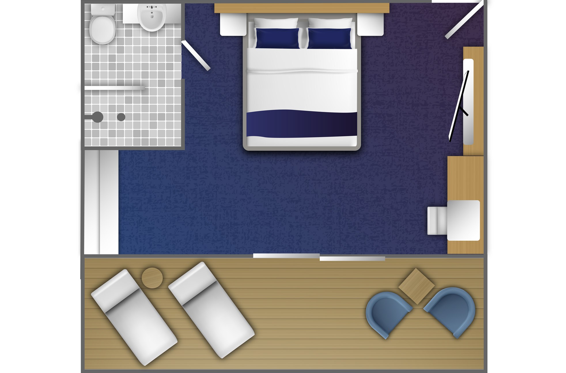
-


- Balcony
- Double bed or two single beds
- Bathroom with a shower
- Selection of bath products (body wash, lotion, shampoo) and hair dryer
- Bathrobes and slippers
- Desk and a chair
- Refrigerator
- Private air conditioning
- Television
- Wi-Fi access (basic service included)
- Several 230V outlets and USB ports
- Safety box
- Approximately 269–323 square feet (25–30 m²)
- Cabin layout and size may vary
![Deck 4]()
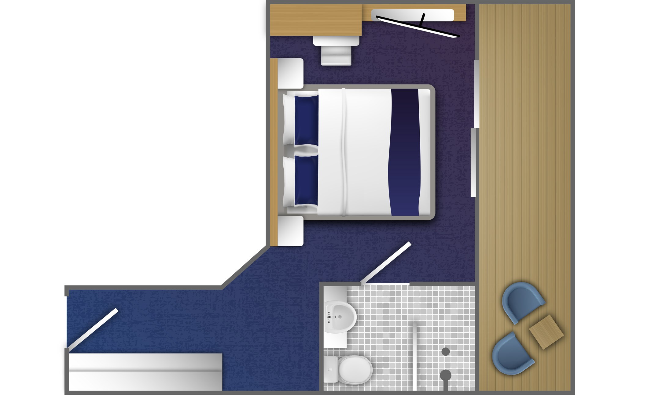
-


- Balcony
- Double bed or twin beds
- Bathroom with a shower
- Selection of bath products (body wash, lotion, shampoo) and hair dryer
- Bathrobes and slippers
- Seating area featuring a sofa, table, and chair
- Optional connecting staterooms available upon request
- Refrigerator
- Private air conditioning
- Television
- Wi-Fi access (basic service included)
- Several 230V outlets and USB ports
- Safety box
- Approximately 237–269 square feet (22–25 m²)
- Cabin layout and size may vary
![Deck 4]()
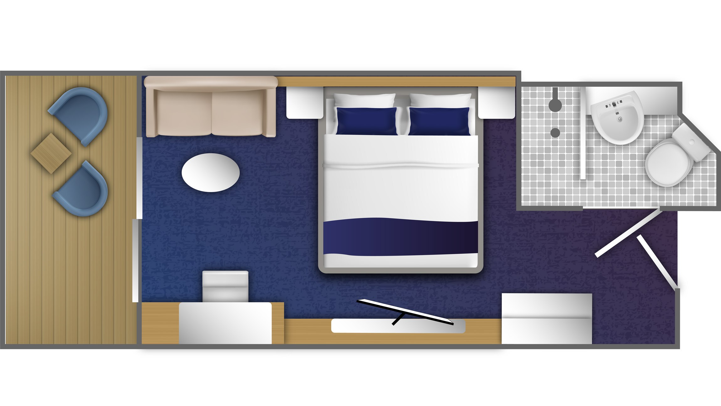
-
- Balcony
- Double bed or twin beds
- Bathroom with a shower
- Selection of bath products (body wash, lotion, shampoo) and hair dryer
- Bathrobes and slippers
- Seating area featuring a sofa, table, and chair
- Optional connecting staterooms available upon request
- Refrigerator
- Private air conditioning
- Television
- Wi-Fi access (basic service included)
- Several 230V outlets and USB ports
- Safety box
- Approximately 237–269 square feet (22–25 m²)
- Cabin layout and size may vary
![Deck 6]()
-


- Balcony
- Double bed or twin beds
- Bathroom with a shower
- Selection of bath products (body wash, lotion, shampoo) and hair dryer
- Bathrobes and slippers
- Desk with a chair
- Refrigerator
- Private air conditioning
- Television
- Wi-Fi access (basic service included)
- Several 230V outlets and USB ports
- Safety box
- Approximately 194–237 square feet (18–22 m²)
- Cabin layout and size may vary
![Deck 4]()
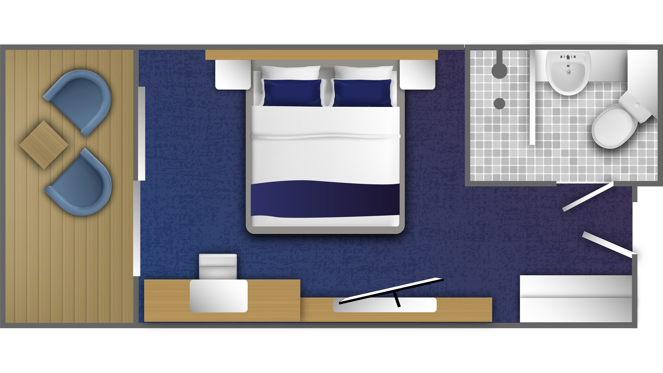
-
- Balcony
- Double bed or twin beds
- Bathroom with a shower
- Selection of bath products (body wash, lotion, shampoo) and hair dryer
- Bathrobes and slippers
- Desk with a chair
- Refrigerator
- Private air conditioning
- Television
- Wi-Fi access (basic service included)
- Several 230V outlets and USB ports
- Safety box
- Approximately 194–237 square feet (18–22 m²)
- Cabin layout and size may vary
![Deck 6]()
-
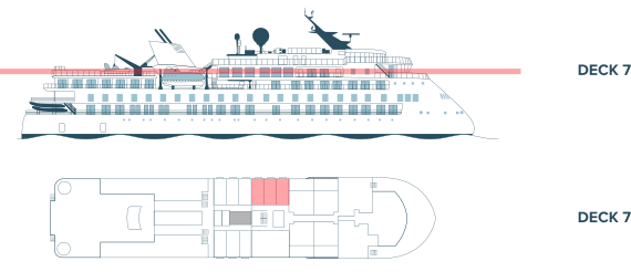
- Floor-to-ceiling windows
- French-style balcony
- One queen size bed
- Bathroom with a shower
- Selection of bath products (body wash, lotion, shampoo) and hair dryer
- Bathrobes and slippers
- Desk with a chair
- Refrigerator
- Private air conditioning
- Television
- Wi-Fi access (basic service included)
- Several 230V outlets and USB ports
- Safety box
- Approximately 151 square feet (14 m²)
- Cabin layout and size may vary
![Deck 7]()
-


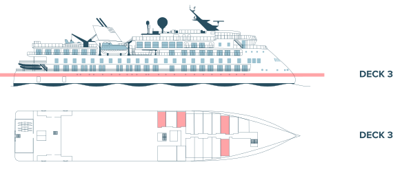
- Porthole window
- Double bed or two single beds
- Bathroom with a shower
- Selection of bath products (body wash, lotion, shampoo) and hair dryer
- Bathrobes and slippers
- Desk and a chair
- Refrigerator
- Private air conditioning
- Television
- Wi-Fi access (basic service included)
- Several 230V outlets and USB ports
- Safety box
- Approximately 140–237 square feet (13–22 m²)
- Cabin layout and size may vary
![Deck 3]()
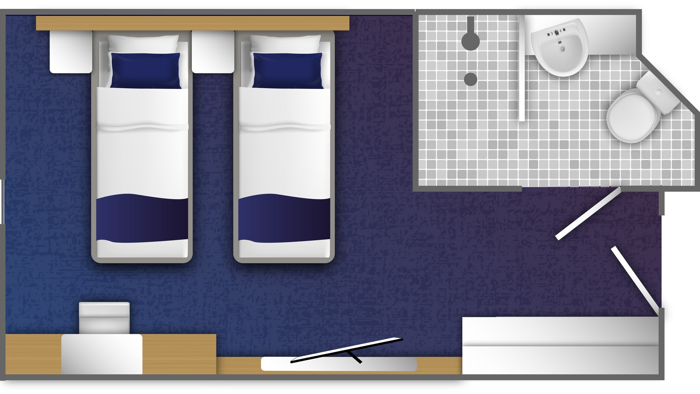
-


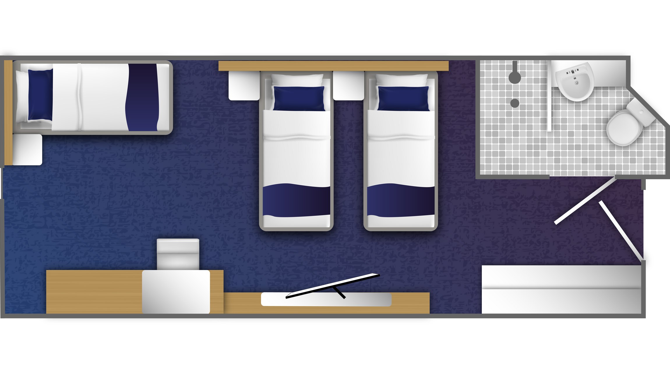
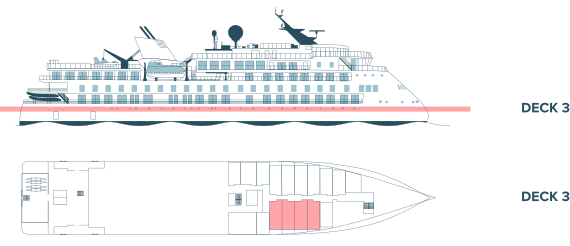
- Porthole window
- Two twin beds or double bed, plus sofa bed
- Bathroom with a shower
- Selection of bath products (body wash, lotion, shampoo) and hair dryer
- Bathrobes and slippers
- Desk and a chair
- Refrigerator
- Private air conditioning
- Television
- Wi-Fi access (basic service included)
- Several 230V outlets and USB ports
- Safety box
- Close to mud room and loading platforms
- Approximately 194–237 square feet (18–22 m²)
- Cabin layout and size may vary
![Deck 3]()






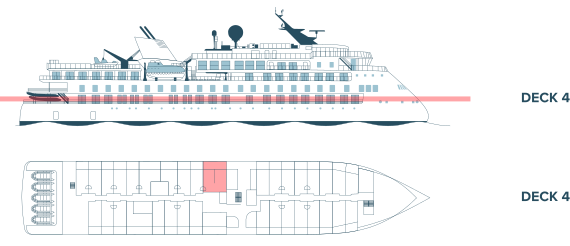


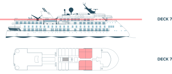


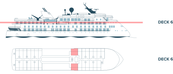


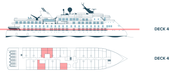


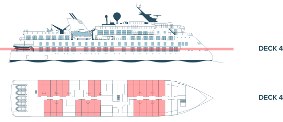
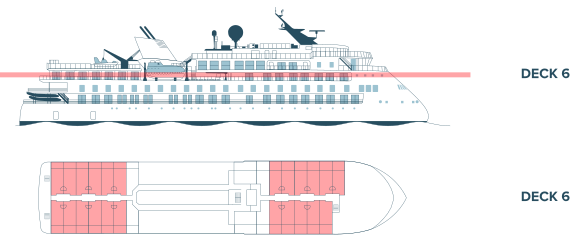


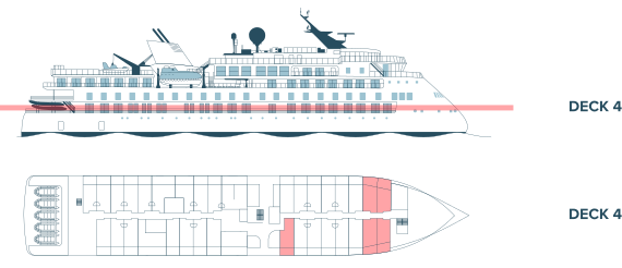
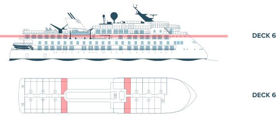




Ship

Ocean Victory
- Purpose-built for exploration with capacity for 175 passengers
- All cabins with ocean views, most with balconies
- New X-BOW® design for more comfortable sea travel
- Low-energy design plus on-board green initiatives for responsible, sustainable travel
Add-ons
2028 Kayaking - Arctic
Limited space available.
$1345 USD per person
Details
-
Out of the Northwest Passage

Special Guest
David JordanExecutive Director, Vancouver Maritime Museum
Tour Dates:
- September 02 - September 18, 2028
From $18,995 to $37,495 USD
per person based on double occupancy
Save 25% Applies to berth cost only.
CAD pricing available for Canadian residents
-
Solo Supplement
Not available
-
Trip Starts
Yellowknife, NT, Canada
Trip Ends
Toronto, ON, Canada
-
Flights
-
Northbound Charter Flight
Yellowknife, NT, Canada to Kugluktuk (Coppermine), NU, Canada.
Price: $1,150 USD
-
Southbound Charter Flight
Kangerlussuaq, Greenland to Toronto, ON, Canada.
Price: $1,700 USD
-
Inclusions and Exclusions
Included:
- Passage aboard the Ocean Victory
- Applicable taxes and credit card fees
- Special access permits, entry, and park fees
- Complimentary expedition jacket
- Expert expedition team
- Guided activities
- Sightseeing and community visits
- All Zodiac excursions
- Port fees
- Pre-departure materials
- Educational program
- Interactive workshops
- Evening entertainment
- All shipboard meals
- Complimentary wine, beer, and soft drinks are served with dinner
- 1 GB complimentary internet access
Not Included:
- Commercial and charter flights
- Program enhancements/optional excursions
- Gratuities
- Personal expenses
- Mandatory medical evacuation insurance
- Additional expenses in the event of delays or itinerary changes
- Possible fuel surcharges and administrative fees
- Pre- and post-trip hotel accommodation
- Kayak program
- Premium Wi-Fi access